
Topografische kaart Bancroft Pond Nature Area
Interactieve kaart
Klik op de kaart om de hoogte weer te geven.
Over deze kaart
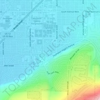
Naam: Topografische kaart Bancroft Pond Nature Area, hoogte, reliëf.
Gemiddelde hoogte: 1.005 m
Minimale hoogte: 965 m
Maximale hoogte: 1.194 m