
Topografische kaart Ramona
Interactieve kaart
Klik op de kaart om de hoogte weer te geven.
Over deze kaart
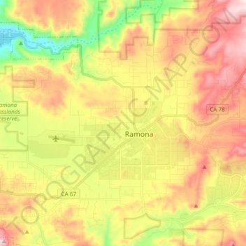
Naam: Topografische kaart Ramona, hoogte, reliëf.
Locatie: Ramona, San Diego County, California, 92065, United States (32.99768 -116.95744 33.09679 -116.80751)
Gemiddelde hoogte: 467 m
Minimale hoogte: 128 m
Maximale hoogte: 809 m
In January 2006, Ramona Valley was designated the country's 162nd American Viticultural Area (AVA) by the Alcohol and Tobacco Tax and Trade Bureau, which recognized the area for its distinctive microclimate, elevation, and soil attributes.
Andere topografische kaarten
Klik op een kaart om zijn topografie, zijn hoogte en zijn reliëf te bekijken.
Ramona
United States > California > San Diego County > Ramona
Ramona, San Diego County, CAL Fire Southern Region, California, 92065, United States
Gemiddelde hoogte: 466 m