
Topografische kaart Swartberg
Interactieve kaart
Klik op de kaart om de hoogte weer te geven.
Over deze kaart
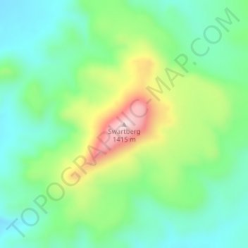
Naam: Topografische kaart Swartberg, hoogte, reliëf.
Gemiddelde hoogte: 1.198 m
Minimale hoogte: 1.088 m
Maximale hoogte: 1.426 m
Andere topografische kaarten
Klik op een kaart om zijn topografie, zijn hoogte en zijn reliëf te bekijken.
Gats
RSA > Eastern Cape > Camdeboo Local Municipality
Gats, Camdeboo Local Municipality, Sarah Baartman District Municipality, Eastern Cape, RSA
Gemiddelde hoogte: 1.160 m
Hanglip
RSA > Eastern Cape > Camdeboo Local Municipality
Hanglip, Camdeboo Local Municipality, Sarah Baartman District Municipality, Eastern Cape, RSA
Gemiddelde hoogte: 1.178 m