
Topografische kaart Stanhope Beach
Interactieve kaart
Klik op de kaart om de hoogte weer te geven.
Over deze kaart
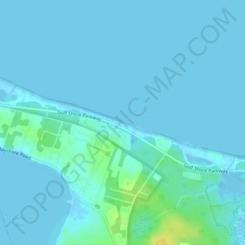
Naam: Topografische kaart Stanhope Beach, hoogte, reliëf.
Gemiddelde hoogte: 3 m
Minimale hoogte: -7 m
Maximale hoogte: 22 m
Andere topografische kaarten
Klik op een kaart om zijn topografie, zijn hoogte en zijn reliëf te bekijken.
Stanhope Beach
Canada > Prince Edward Island > Queens County > Stanhope
Stanhope Beach, Stanhope, Rural Municipality of North Shore, Queens County, Prince Edward Island, Canada
Gemiddelde hoogte: 3 m