
Topografische kaart Rajsamand
Klik op de kaart om de hoogte weer te geven.
Rajsamand
Rajsamand is located at 25°04′N 73°53′E / 25.07°N 73.88°E / 25.07; 73.88. It has an average elevation of 547 metres (1794 ft).
Over deze kaart
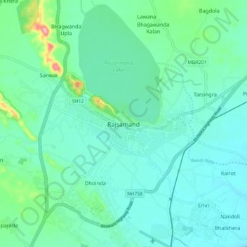
Naam: Topografische kaart Rajsamand, hoogte, reliëf.
Gemiddelde hoogte: 552 m
Minimale hoogte: 523 m
Maximale hoogte: 686 m