
Topografische kaart Bolar
Interactieve kaart
Klik op de kaart om de hoogte weer te geven.
Over deze kaart
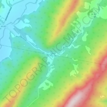
Naam: Topografische kaart Bolar, hoogte, reliëf.
Locatie: Bolar, Highland County, Virginia, United States (38.19735 -79.69644 38.23735 -79.65644)
Gemiddelde hoogte: 798 m
Minimale hoogte: 628 m
Maximale hoogte: 1.119 m
Andere topografische kaarten
Klik op een kaart om zijn topografie, zijn hoogte en zijn reliëf te bekijken.
McDowell
United States > Virginia > Highland County
McDowell, Highland County, Virginia, 24458, United States
Gemiddelde hoogte: 716 m
Trimble
United States > Virginia > Highland County > Trimble
Trimble, Highland County, Virginia, United States
Gemiddelde hoogte: 893 m
Monterey
United States > Virginia > Highland County
Monterey, Highland County, Virginia, United States
Gemiddelde hoogte: 921 m