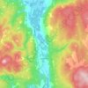
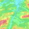
Topografische kaart McCallum Gulch
Klik op de kaart om de hoogte weer te geven.
Over deze kaart

Naam: Topografische kaart McCallum Gulch, hoogte, reliëf.
Gemiddelde hoogte: 148 m
Minimale hoogte: 3 m
Maximale hoogte: 255 m
Andere topografische kaarten
Klik op een kaart om zijn topografie, zijn hoogte en zijn reliëf te bekijken.


Advocate Harbour
Canada > Nova Scotia > Municipality of the County of Cumberland
Gemiddelde hoogte: 41 m


East Mapleton
Canada > Nova Scotia > Municipality of the County of Cumberland
Gemiddelde hoogte: 186 m



West Wentworth
Canada > Nova Scotia > Municipality of the County of Cumberland
Gemiddelde hoogte: 67 m


Diligent River
Canada > Nova Scotia > Municipality of the County of Cumberland
Gemiddelde hoogte: 99 m


Tidnish Cross Road
Canada > Nova Scotia > Municipality of the County of Cumberland
Gemiddelde hoogte: 17 m


West Leicester
Canada > Nova Scotia > Municipality of the County of Cumberland
Gemiddelde hoogte: 114 m

East Southampton
Canada > Nova Scotia > Municipality of the County of Cumberland
Gemiddelde hoogte: 58 m


Malagash Centre
Canada > Nova Scotia > Municipality of the County of Cumberland
Gemiddelde hoogte: 10 m


Greenville Station
Canada > Nova Scotia > Municipality of the County of Cumberland
Gemiddelde hoogte: 93 m




East Leicester
Canada > Nova Scotia > Municipality of the County of Cumberland
Gemiddelde hoogte: 86 m


Higgins Mountain
Canada > Nova Scotia > Municipality of the County of Cumberland
Gemiddelde hoogte: 275 m


Oxford Junction
Canada > Nova Scotia > Municipality of the County of Cumberland
Gemiddelde hoogte: 42 m
West Wentworth
Canada > Nova Scotia > Municipality of the County of Cumberland
Gemiddelde hoogte: 67 m