Geolokaliseren

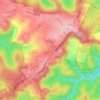
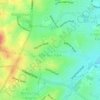
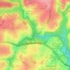
Topografische kaart Port Hacking

Klik op de kaart om de hoogte weer te geven.

Over deze kaart

Naam: Topografische kaart Port Hacking, hoogte, reliëf.

Locatie: Port Hacking, Maianbar, Sutherland Shire, Sydney, New South Wales, 2230, Australia (-34.07358 151.12608 -34.07348 151.12618)

Gemiddelde hoogte: 21 m

Minimale hoogte: -6 m

Maximale hoogte: 100 m

Andere topografische kaarten

Klik op een kaart om zijn topografie, zijn hoogte en zijn reliëf te bekijken.
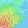
Northern Beaches

Australia > New South Wales > Sydney

Gemiddelde hoogte: 67 m

Penrith

Australia > New South Wales > Sydney > Penrith

Penrith is a city in New South Wales, Australia, located in Greater Western Sydney, 55 kilometres (31 mi) west of the Sydney central business district on the banks of the Nepean River, on the outskirts of the Cumberland Plain. Its elevation is 32 metres (105 ft).

Gemiddelde hoogte: 34 m

Bankstown

Australia > New South Wales > Sydney

Gemiddelde hoogte: 34 m

Wentworth Falls

Australia > New South Wales > Sydney

Wentworth Falls (postcode: 2782) is a town in the Blue Mountains region of New South Wales, situated approximately 100 kilometres (62 mi) west of the Sydney central business district, and about 8 kilometres (5.0 mi) east of Katoomba, Australia on the Great Western Highway, with a Wentworth Falls railway…

Gemiddelde hoogte: 708 m
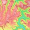
St Ives

Australia > New South Wales > Sydney

Gemiddelde hoogte: 125 m

Scotland Island

Australia > New South Wales > Sydney

Gemiddelde hoogte: 17 m

Baulkham Hills

Australia > New South Wales > Sydney

Gemiddelde hoogte: 93 m

Kurnell

Australia > New South Wales > Sydney

Gemiddelde hoogte: 4 m

Terrey Hills

Australia > New South Wales > Sydney

Owing to its elevation and close proximity to the ocean, as well as its extensive tree canopy cover, the weather station at Terrey Hills records the mildest temperatures of any weather station in the Greater Sydney region. Under Köppen's scheme, the suburb has a borderline humid subtropical (Cfa) and oceanic…

Gemiddelde hoogte: 146 m
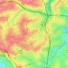
Epping

Australia > New South Wales > Sydney

Gemiddelde hoogte: 96 m

Engadine

Australia > New South Wales > Sydney

Gemiddelde hoogte: 121 m

Zetland

Australia > New South Wales > Sydney

Gemiddelde hoogte: 26 m

Sydney

Australia > New South Wales > Sydney

Gemiddelde hoogte: 23 m

Thornleigh

Australia > New South Wales > Sydney

Thornleigh is bounded to the north by Waitara Creek and south by the Lane Cove National Park. Thornleigh borders the suburbs of Normanhurst, Hornsby, Wahroonga, Westleigh and Pennant Hills. Thornleigh offers great district views, and the topography varies greatly with many established areas built around…

Gemiddelde hoogte: 159 m

Blacktown

Australia > New South Wales > Sydney

Gemiddelde hoogte: 57 m

Oakhurst

Australia > New South Wales > Sydney

Gemiddelde hoogte: 49 m

Newport

Australia > New South Wales > Sydney

Gemiddelde hoogte: 27 m

Inner West Council

Australia > New South Wales > Sydney

Gemiddelde hoogte: 19 m

Mosman

Australia > New South Wales > Sydney

Gemiddelde hoogte: 29 m

Leichhardt

Australia > New South Wales > Sydney

Gemiddelde hoogte: 22 m

Ashfield

Australia > New South Wales > Sydney

Gemiddelde hoogte: 26 m

Roseville

Australia > New South Wales > Sydney

Gemiddelde hoogte: 84 m

Ryde

Australia > New South Wales > Sydney

Gemiddelde hoogte: 52 m

Warragamba Dam

Australia > New South Wales > Sydney

Gemiddelde hoogte: 156 m

Bents Basin State Conservation Area

Australia > New South Wales > Sydney

The park is popular for swimming, kayaking, bushwalking, camping (with 100 tent sites), barbecuing, picnicking and fishing. The park also features walking trails within a bushland and an education centre with a commercial kitchen. Caley's Lookout Track, a walking track within the bushland, leads to Little…

Gemiddelde hoogte: 82 m

Enmore

Australia > New South Wales > Sydney

Gemiddelde hoogte: 23 m

Edensor Park

Australia > New South Wales > Sydney

Gemiddelde hoogte: 57 m

Waverton

Australia > New South Wales > Sydney

Gemiddelde hoogte: 33 m

Randwick

Australia > New South Wales > Sydney

Gemiddelde hoogte: 44 m

Eastwood

Australia > New South Wales > Sydney

Gemiddelde hoogte: 80 m

Wolli Creek

Australia > New South Wales > Sydney

Gemiddelde hoogte: 27 m

Botany Bay

Australia > New South Wales > Sydney

Gemiddelde hoogte: 8 m

Mascot

Australia > New South Wales > Sydney

Gemiddelde hoogte: 8 m

Camden Council

Australia > New South Wales > Sydney

Gemiddelde hoogte: 90 m

Narrabeen

Australia > New South Wales > Sydney

Gemiddelde hoogte: 17 m

Glenfield

Australia > New South Wales > Sydney

Gemiddelde hoogte: 29 m

Leppington

Australia > New South Wales > Sydney

Gemiddelde hoogte: 89 m

Belrose

Australia > New South Wales > Sydney

Gemiddelde hoogte: 124 m

Picnic Point

Australia > New South Wales > Sydney

Gemiddelde hoogte: 24 m

Allambie Heights

Australia > New South Wales > Sydney

Gemiddelde hoogte: 77 m

Marrickville

Australia > New South Wales > Sydney

Gemiddelde hoogte: 17 m

Narellan

Australia > New South Wales > Sydney

Gemiddelde hoogte: 88 m

Bilgola Beach

Australia > New South Wales > Sydney

Gemiddelde hoogte: 35 m

Ku-ring-gai Chase National Park

Australia > New South Wales > Sydney

Ku-ring-gai Chase is part of the Hornsby Plateau, a massive block of sandstone tilting upwards to the north. The park comprises a plateau with an elevation of generally 150–200 m above sea level. Between 250 and 200 million years ago, sand silt and mud was deposited by rivers across flood plains. These…

Gemiddelde hoogte: 83 m

Kingsford

Australia > New South Wales > Sydney

Gemiddelde hoogte: 32 m

Freshwater

Australia > New South Wales > Sydney

Gemiddelde hoogte: 14 m

Lugarno

Australia > New South Wales > Sydney

Gemiddelde hoogte: 28 m

Bondi Beach

Australia > New South Wales > Sydney

Gemiddelde hoogte: 31 m

Fairlight

Australia > New South Wales > Sydney

Gemiddelde hoogte: 23 m

Lake Sedgwick

Australia > New South Wales > Sydney

Gemiddelde hoogte: 117 m

St Clair

Australia > New South Wales > Sydney

Gemiddelde hoogte: 48 m

Tambourine Creek

Australia > New South Wales > Sydney

Gemiddelde hoogte: 39 m

Sutherland Shire

Australia > New South Wales > Sydney

Gemiddelde hoogte: 79 m

Heffron Park

Australia > New South Wales > Sydney

Gemiddelde hoogte: 26 m

Eastern Suburbs

Australia > New South Wales > Sydney

Gemiddelde hoogte: 12 m

Thornton Park

Australia > New South Wales > Sydney

Gemiddelde hoogte: 12 m

Jim Walsh Park

Australia > New South Wales > Sydney

Gemiddelde hoogte: 80 m

Redfern Park

Australia > New South Wales > Sydney

Gemiddelde hoogte: 31 m

Yeramba Lagoon

Australia > New South Wales > Sydney

Gemiddelde hoogte: 27 m

Beacon Hill

Australia > New South Wales > Sydney

Gemiddelde hoogte: 91 m

Nield Park

Australia > New South Wales > Sydney

Gemiddelde hoogte: 15 m

Powells Creek

Australia > New South Wales > Sydney

Gemiddelde hoogte: 9 m

Melrose Park

Australia > New South Wales > Sydney

Gemiddelde hoogte: 23 m

Denistone East

Australia > New South Wales > Sydney

Gemiddelde hoogte: 66 m

Scheyville

Australia > New South Wales > Sydney

Gemiddelde hoogte: 38 m

Kirribilli

Australia > New South Wales > Sydney

Gemiddelde hoogte: 20 m

Koala Park

Australia > New South Wales > Sydney

Gemiddelde hoogte: 149 m

Emu Heights

Australia > New South Wales > Sydney

Gemiddelde hoogte: 87 m

Nielsen Park

Australia > New South Wales > Sydney

As is common in all coastal and estuarine areas of the Sydney Region, the Park contains many rock outcrops, particularly along the foreshore headlands. These are given some added interest by the remnants of the effect of a basalt dyke that runs from Mount Trefle to Bottle and Glass Point resulting in the…

Gemiddelde hoogte: 14 m

UTS Alumni Green

Australia > New South Wales > Sydney

Gemiddelde hoogte: 29 m

Lucas Heights

Australia > New South Wales > Sydney

Due to its elevation, Lucas Heights is one of the few places in Sydney that has a borderline Oceanic (Cfb) and a Humid subtropical climate (Cfa).

Gemiddelde hoogte: 115 m
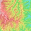
Woodford

Australia > New South Wales > Sydney

Woodford is a village in the Blue Mountains in New South Wales, Australia, about 90 kilometres west of Sydney. Its elevation is 609 metres (1,998 ft) above sea level. It is situated on the Great Western Highway and has a railway station (opened in 1868 as Buss's Platform) on the Main Western railway line…

Gemiddelde hoogte: 544 m
Hurstville

Australia > New South Wales > Sydney

Gemiddelde hoogte: 50 m

Rockdale

Australia > New South Wales > Sydney

Gemiddelde hoogte: 20 m

Wicks Park

Australia > New South Wales > Sydney

Gemiddelde hoogte: 17 m

Bella Vista

Australia > New South Wales > Sydney

Gemiddelde hoogte: 79 m

Berkshire Park

Australia > New South Wales > Sydney

Gemiddelde hoogte: 27 m

St Leonards

Australia > New South Wales > Sydney

Gemiddelde hoogte: 69 m

Meadowbank Park

Australia > New South Wales > Sydney

Gemiddelde hoogte: 14 m

Denistone West

Australia > New South Wales > Sydney

Gemiddelde hoogte: 55 m

Nelson

Australia > New South Wales > Sydney

Gemiddelde hoogte: 47 m

Beaconsfield

Australia > New South Wales > Sydney

Gemiddelde hoogte: 18 m

Smithfield

Australia > New South Wales > Sydney

Established in 1836, Smithfield was the first major settlement of the Fairfield LGA. The original 1838 summary plan of Smithfield shows the suburb laid out in a grid pattern with most of the streets having the same names as they do today. Its altitude ranges from 21 to 48 m (69 to 157 ft) above sea level.…

Gemiddelde hoogte: 33 m

Beaman Park

Australia > New South Wales > Sydney

Gemiddelde hoogte: 23 m

Browns Waterhole

Australia > New South Wales > Sydney

Gemiddelde hoogte: 73 m

Holroyd

Australia > New South Wales > Sydney

Gemiddelde hoogte: 24 m

Richmond Lowlands

Australia > New South Wales > Sydney

Gemiddelde hoogte: 13 m

Oyster Bay

Australia > New South Wales > Sydney

Gemiddelde hoogte: 25 m

Killarney Heights

Australia > New South Wales > Sydney

Gemiddelde hoogte: 72 m

North Curl Curl

Australia > New South Wales > Sydney

Gemiddelde hoogte: 22 m

Darlinghurst

Australia > New South Wales > Sydney

Gemiddelde hoogte: 38 m

Rust jezelf uit voor je volgende avontuur:

🔌Reisadapters - Voor de grensstreken en internationale trips
🥾Wandelschoenen Heren - Comfortabele en duurzame wandelschoenen voor elk terrein
🏔️Altimeters - Meet nauwkeurig hoogteverschillen tijdens wandelingen
🌞Zonne-laders - Gratis energie van de zon voor je gadgets
🦯Nordic Walking Stokken - Specifieke stokken voor sportief wandelen

Als Amazon-partner verdient deze site een commissie op in aanmerking komende aankopen, zonder extra kosten voor jou.