
Topografische kaart Kelseyville
Interactieve kaart
Klik op de kaart om de hoogte weer te geven.
Kelseyville
Kelseyville is a census-designated place (CDP) in Lake County, California, United States. Kelseyville is located 6 miles (9.7 km) southeast of Lakeport, at an elevation of 1,384 feet (422 m). The population was 3,353 at the 2010 census, up from 2,928 at the 2000 census.
Over deze kaart
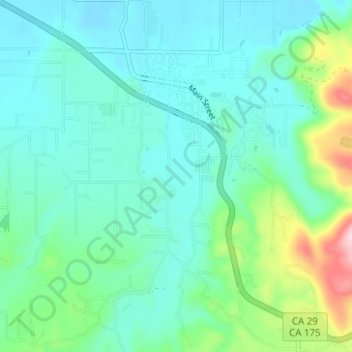
Naam: Topografische kaart Kelseyville, hoogte, reliëf.
Gemiddelde hoogte: 462 m
Minimale hoogte: 409 m
Maximale hoogte: 668 m