
Topografische kaart Dublin
Interactieve kaart
Klik op de kaart om de hoogte weer te geven.
Over deze kaart
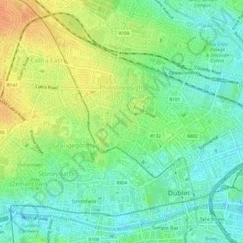
Naam: Topografische kaart Dublin, hoogte, reliëf.
Locatie: Dublin, County Dublin, Leinster, Irland (53.35717 -6.27140 53.35735 -6.27101)
Gemiddelde hoogte: 19 m
Minimale hoogte: 2 m
Maximale hoogte: 42 m
Andere topografische kaarten
Klik op een kaart om zijn topografie, zijn hoogte en zijn reliëf te bekijken.
St. George's Parish
St. George's Parish, Inns Quay A ED, Dublin, Dublin 1, Leinster, Irland
Gemiddelde hoogte: 16 m
Cherry Orchard
Cherry Orchard, Merchants Quay E ED, Dublin 8, Dublin, County Dublin, Leinster, Irland
Gemiddelde hoogte: 25 m
North Bull Island
North Bull Island, Raheny St. Assam ED, Dublin 5, Dublin, County Dublin, Leinster, Irland
Gemiddelde hoogte: 2 m