
Topografische kaart Val-d'Or
Interactieve kaart
Klik op de kaart om de hoogte weer te geven.
Over deze kaart
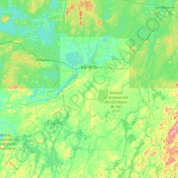
Naam: Topografische kaart Val-d'Or, hoogte, reliëf.
Gemiddelde hoogte: 331 m
Minimale hoogte: 287 m
Maximale hoogte: 551 m
Val-d'Or is situated on the Canadian Shield at an elevation of 1100 feet (330m) above sea level. Although its name refers to a valley ("Val"), the city is actually situated on a vast, slightly undulating plain.