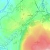
Topografische kaart Coppull
Klik op de kaart om de hoogte weer te geven.
Coppull
The settlement has an Anglo Saxon name describing its topography derived from the Old English copp a hill top and hyll a hill. The township was variously recorded as Cophull and Cophulle in 1277, Copphull in 1351, Copthull in 1374 and Coppull from 1444.
Over deze kaart
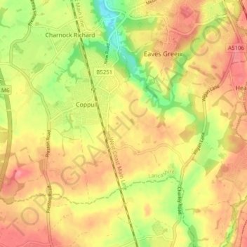
Naam: Topografische kaart Coppull, hoogte, reliëf.
Locatie: Coppull, Chorley, Lancashire, England, United Kingdom (53.60322 -2.69945 53.63320 -2.62215)
Gemiddelde hoogte: 80 m
Minimale hoogte: 38 m
Maximale hoogte: 111 m
Andere topografische kaarten
Klik op een kaart om zijn topografie, zijn hoogte en zijn reliëf te bekijken.