
Topografische kaart Ingleside on the Bay
Interactieve kaart
Klik op de kaart om de hoogte weer te geven.
Over deze kaart
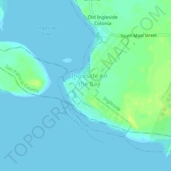
Naam: Topografische kaart Ingleside on the Bay, hoogte, reliëf.
Locatie: Ingleside on the Bay, San Patricio County, Texas, USA (27.82182 -97.22835 27.83803 -97.21508)
Gemiddelde hoogte: 4 m
Minimale hoogte: -1 m
Maximale hoogte: 16 m