
Topografische kaart Sioux Lookout
Interactieve kaart
Klik op de kaart om de hoogte weer te geven.
Over deze kaart
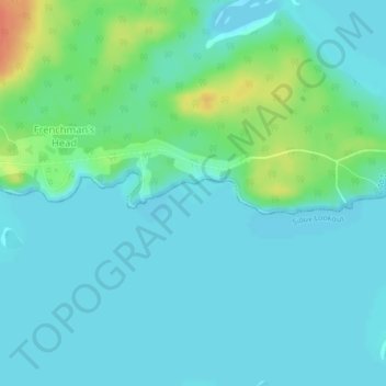
Naam: Topografische kaart Sioux Lookout, hoogte, reliëf.
Gemiddelde hoogte: 363 m
Minimale hoogte: 353 m
Maximale hoogte: 397 m
Andere topografische kaarten
Klik op een kaart om zijn topografie, zijn hoogte en zijn reliëf te bekijken.
Loveland Lake
Canada > Ontario > Kenora District > Unorganized Kenora District
Loveland Lake, Unorganized Kenora District, Kenora District, Northwestern Ontario, Ontario, Canada
Gemiddelde hoogte: 426 m
P.E.I.
Canada > Ontario > Kenora District > Unorganized Kenora District
P.E.I., Unorganized Kenora District, Kenora District, Northwestern Ontario, Ontario, Canada
Gemiddelde hoogte: 317 m
Edison Lake
Canada > Ontario > Kenora District > Unorganized Kenora District
Edison Lake, Unorganized Kenora District, Kenora District, Northwestern Ontario, Ontario, Canada
Gemiddelde hoogte: 385 m
Nungesser Lake
Canada > Ontario > Kenora District > Unorganized Kenora District
Nungesser Lake, Unorganized Kenora District, Kenora District, Northwestern Ontario, Ontario, Canada
Gemiddelde hoogte: 412 m
Eagle Lake
Canada > Ontario > Kenora District > Machin Township
Eagle Lake, Machin Township, Kenora District, Northwestern Ontario, Ontario, Canada
Gemiddelde hoogte: 374 m
Sandy Lake
Canada > Ontario > Kenora District
Sandy Lake, Kenora District, Northwestern Ontario, Ontario, Canada
Gemiddelde hoogte: 284 m
Neskantaga
Canada > Ontario > Kenora District
Neskantaga, Kenora District, Northwestern Ontario, Ontario, Canada
Gemiddelde hoogte: 249 m
Cole Lake
Canada > Ontario > Kenora District > Unorganized Kenora District
Cole Lake, Unorganized Kenora District, Kenora District, Northwestern Ontario, Ontario, Canada
Gemiddelde hoogte: 417 m
Sioux Narrows
Canada > Ontario > Kenora District > Sioux Narrows-Nestor Falls Township
Sioux Narrows, Sioux Narrows-Nestor Falls Township, Kenora District, Northwestern Ontario, Ontario, P0X 1N0, Canada
Gemiddelde hoogte: 329 m
Banana Island
Canada > Ontario > Kenora District > Unorganized Kenora District
Banana Island, Unorganized Kenora District, Kenora District, Northwestern Ontario, Ontario, Canada
Gemiddelde hoogte: 359 m
Almo Lake
Canada > Ontario > Kenora District > Unorganized Kenora District
Almo Lake, Unorganized Kenora District, Kenora District, Northwestern Ontario, Ontario, Canada
Gemiddelde hoogte: 366 m
Forbes Lake
Canada > Ontario > Kenora District > Sioux Narrows-Nestor Falls Township
Forbes Lake, Sioux Narrows-Nestor Falls Township, Kenora District, Northwestern Ontario, Ontario, Canada
Gemiddelde hoogte: 373 m
Ghost Island
Canada > Ontario > Kenora District > Unorganized Kenora District
Ghost Island, Unorganized Kenora District, Kenora District, Northwestern Ontario, Ontario, Canada
Gemiddelde hoogte: 401 m
Look Lake
Canada > Ontario > Kenora District > Unorganized Kenora District
Look Lake, Unorganized Kenora District, Kenora District, Northwestern Ontario, Ontario, Canada
Gemiddelde hoogte: 393 m
Sunlight Lake
Canada > Ontario > Kenora District > Unorganized Kenora District
Sunlight Lake, Unorganized Kenora District, Kenora District, Northwestern Ontario, Ontario, Canada
Gemiddelde hoogte: 374 m
Kenora
Canada > Ontario > Kenora District > Kenora
Kenora, Kenora District, Northwestern Ontario, Ontario, Canada
Gemiddelde hoogte: 336 m
Red Lake
Canada > Ontario > Kenora District
Red Lake, Kenora District, Northwestern Ontario, Ontario, Canada
Gemiddelde hoogte: 382 m
Nestor Falls
Canada > Ontario > Kenora District > Sioux Narrows-Nestor Falls Township
Nestor Falls, Sioux Narrows-Nestor Falls Township, Kenora District, Northwestern Ontario, Ontario, P0X 1K0, Canada
Gemiddelde hoogte: 337 m