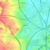
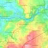
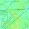
Topografische kaart Fenwick
Klik op de kaart om de hoogte weer te geven.
Fenwick
Fenwick is a small village and civil parish in the Metropolitan Borough of Doncaster (part of South Yorkshire, England), on the border with North Yorkshire. It was historically part of the West Riding of Yorkshire until 1974. It is located at an elevation of around 6 metres above sea level and had a population of 113, increasing slightly to 121 at the 2011 Census. The northern boundary of the parish is marked by the River Went.
Over deze kaart

Naam: Topografische kaart Fenwick, hoogte, reliëf.
Locatie: Fenwick, Doncaster, South Yorkshire, England, United Kingdom (53.62213 -1.13683 53.65173 -1.06551)
Gemiddelde hoogte: 7 m
Minimale hoogte: 3 m
Maximale hoogte: 10 m
Andere topografische kaarten
Klik op een kaart om zijn topografie, zijn hoogte en zijn reliëf te bekijken.