
Topografische kaart mirador de loreto
Interactieve kaart
Klik op de kaart om de hoogte weer te geven.
Over deze kaart
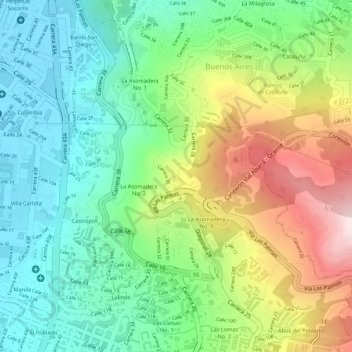
Naam: Topografische kaart mirador de loreto, hoogte, reliëf.
Gemiddelde hoogte: 1.656 m
Minimale hoogte: 1.476 m
Maximale hoogte: 1.953 m
Andere topografische kaarten
Klik op een kaart om zijn topografie, zijn hoogte en zijn reliëf te bekijken.
Comuna 13 - San Javier
Colombia > Antioquia > Medellín
Comuna 13's geography has played a role in how criminal actors took advantage of the commune as a strategic location, using elevation to better survey the movement of police and rival groups. The elevation additionally played a historical role, as Comuna 13 began as a farming community.
Gemiddelde hoogte: 1.713 m