
Topografische kaart Graton
Interactieve kaart
Klik op de kaart om de hoogte weer te geven.
Over deze kaart
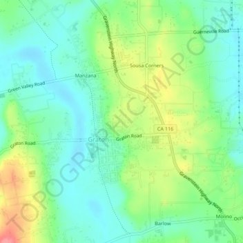
Naam: Topografische kaart Graton, hoogte, reliëf.
Locatie: Graton, Sonoma County, California, 95444, United States (38.42220 -122.87740 38.45507 -122.85053)
Gemiddelde hoogte: 50 m
Minimale hoogte: 20 m
Maximale hoogte: 110 m
Graton is located at the southeastern end of Green Valley, on the east bank of the seasonally flooding Atascadero Creek. The elevation ranges from approximately 85 feet (26 m) above Mean Sea Level (MSL) at Atascadero Creek to 213 feet (65 m) MSL at Oak Grove School.