

Topografische kaart Kathua
Klik op de kaart om de hoogte weer te geven.
Kathua
Kathua is located at 32°22′N 75°31′E / 32.37°N 75.52°E / 32.37; 75.52, at the foothills of Sivaliks. It has an average elevation of 393 metres (1,289 ft). The city is surrounded by three rivers. Ravi is 7 km (4.3 mi) down Kathua while Ujjh is about 11 km (6.8 mi) ahead on Jammu Highway. Kathua itself is situated along the banks of a khad (Dogri term for seasonal stream or rivulet), dividing it into two boroughs: Parliwand, meaning the other side; and Orliwand, meaning this side. Itself being a Plain the area is surrounded in the North by Sivalik hills and snow-capped Pir Panjal range. The large Ranjit Sagar Lake is 25 kms away and has a cooling effect on its climate. Kathua lies 88 kilometres south of Jammu.
Over deze kaart
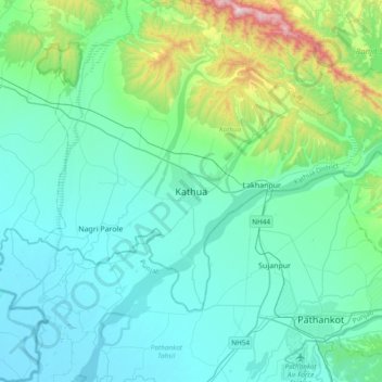
Naam: Topografische kaart Kathua, hoogte, reliëf.
Locatie: Kathua, Kathua district, Jammu and Kashmir, 184101, India (32.21655 75.36430 32.53655 75.68430)
Gemiddelde hoogte: 411 m
Minimale hoogte: 259 m
Maximale hoogte: 1.248 m