
Topografische kaart Abbeville
Interactieve kaart
Klik op de kaart om de hoogte weer te geven.
Over deze kaart
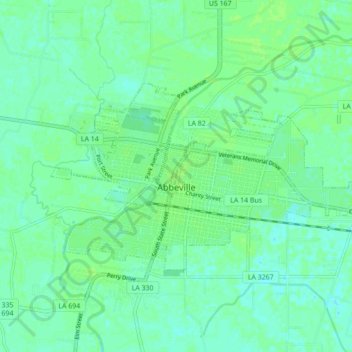
Naam: Topografische kaart Abbeville, hoogte, reliëf.
Locatie: Abbeville, Vermilion Parish, Louisiana, 70510, United States (29.95691 -92.16533 29.99695 -92.07840)
Gemiddelde hoogte: 5 m
Minimale hoogte: -1 m
Maximale hoogte: 9 m
Abbeville is located at 29°58′31.422″N 92°7′37.7652″W / 29.97539500°N 92.127157000°W / 29.97539500; -92.127157000 and has an elevation of 16 feet (4.9 m). According to the United States Census Bureau, the town has a total area of 5.7 square miles (14.7629 km2), of which 5.7 square miles (15 km2) is land and 0.04 square miles (0.10 km2) (0.53%) is water. Abbeville is located near the southern terminus of U.S. Highway 167. Abbeville Chris Crusta Memorial Airport is in the eastern part of the city. The Vermilion River runs through downtown, and several canals and coulees run through other parts of Abbeville.
Andere topografische kaarten
Klik op een kaart om zijn topografie, zijn hoogte en zijn reliëf te bekijken.
Kaplan
United States > Louisiana > Vermilion Parish
Kaplan, Vermilion Parish, Louisiana, United States
Gemiddelde hoogte: 5 m
Indian Bayou
United States > Louisiana > Vermilion Parish
Indian Bayou, Vermilion Parish, Louisiana, United States
Gemiddelde hoogte: 7 m
Rose Hill
United States > Louisiana > Vermilion Parish > Rose Hill
Rose Hill, Vermilion Parish, Louisiana, 70575, United States
Gemiddelde hoogte: 3 m