
Topografische kaart Bürgenstock
Interactieve kaart
Klik op de kaart om de hoogte weer te geven.
Over deze kaart
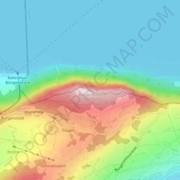
Naam: Topografische kaart Bürgenstock, hoogte, reliëf.
Locatie: Bürgenstock, Ennetbürgen, Nidwalden, 6373, Switzerland (47.00026 8.39828 47.00036 8.39838)
Gemiddelde hoogte: 641 m
Minimale hoogte: 431 m
Maximale hoogte: 1.096 m
On the Dufourkarte (Dufour Map), the topographic map of Switzerland from 1844 to 1864, the mountain ridge as a whole had no name. The highest crest was referred to as Hametschwand.