
Topografische kaart Pampady
Interactieve kaart
Klik op de kaart om de hoogte weer te geven.
Over deze kaart
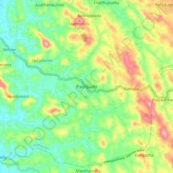
Naam: Topografische kaart Pampady, hoogte, reliëf.
Locatie: Pampady, Kottayam, Kottayam District, Kerala, 686502, India (9.54563 76.62436 9.58563 76.66436)
Gemiddelde hoogte: 55 m
Minimale hoogte: 17 m
Maximale hoogte: 135 m
Andere topografische kaarten
Klik op een kaart om zijn topografie, zijn hoogte en zijn reliëf te bekijken.
Nellikunnu
India > Kerala > Kottayam > Mattakkara
Nellikunnu, Mattakkara, Kottayam, Kerala, India
Gemiddelde hoogte: 50 m