
Topografische kaart Cerro de Punta
Interactieve kaart
Klik op de kaart om de hoogte weer te geven.
Cerro de Punta
The mountain is part of the Cordillera Central and is located on the border between the municipalities of Jayuya and Ponce. The access road to the point closest to the highest elevation is from the municipality of Jayuya. It is part of the Toro Negro Forest Reserve, and it has been described as "an alpine runt." It is located on the western end of the Toro Negro State Park. The mountain is just north of east-to-westbound Route 143. It is located at coordinates 18.172458 and -66.591839W. The nearest populated place to Cerro de Punta is Urbanización Vega Linda, located 3.3 miles (5.3 km) away.
Over deze kaart
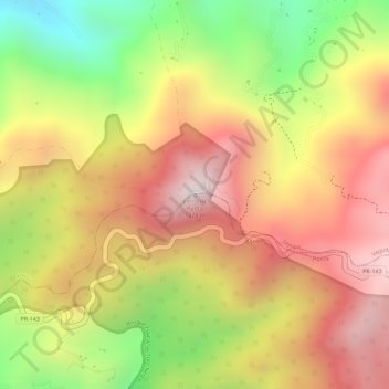
Naam: Topografische kaart Cerro de Punta, hoogte, reliëf.
Locatie: Cerro de Punta, Ponce, Puerto Rico, 00654, United States (18.17218 -66.59177 18.17228 -66.59167)
Gemiddelde hoogte: 1.021 m
Minimale hoogte: 623 m
Maximale hoogte: 1.309 m
Andere topografische kaarten
Klik op een kaart om zijn topografie, zijn hoogte en zijn reliëf te bekijken.