
Topografische kaart Santa Rita
Interactieve kaart
Klik op de kaart om de hoogte weer te geven.
Over deze kaart
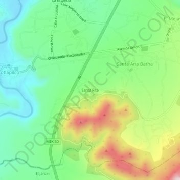
Naam: Topografische kaart Santa Rita, hoogte, reliëf.
Locatie: Santa Rita, Santa Ana Batha, Chilcuautla, Hidalgo, México (20.35159 -99.22122 20.39159 -99.18122)
Gemiddelde hoogte: 1.942 m
Minimale hoogte: 1.776 m
Maximale hoogte: 2.245 m