

Topografische kaart Hosur
Klik op de kaart om de hoogte weer te geven.
Hosur
Hosur experiences a tropical savanna climate (Köppen climate classification) with distinct wet and dry seasons. Due to its high elevation, Hosur usually enjoys salubrious and moderate climate throughout the year, with occasional heat waves. The coolest month is January with an average low temperature of 17.1 °C and the hottest month is May with an average high temperature of 33.6 °C. Winter temperatures rarely drop below 12 °C with the lowest ever recorded temperature of 7.1 °C recorded on 1 February 2018 and summer temperatures seldom exceed 35 °C. Hosur receives rainfall from both the northeast and the southwest monsoons and the wettest months are October, September, and August, in that order. The summer heat is moderated by fairly frequent thunderstorms but no flooding. Average humidity is 31% and average rainfall is 84 cm.
Over deze kaart
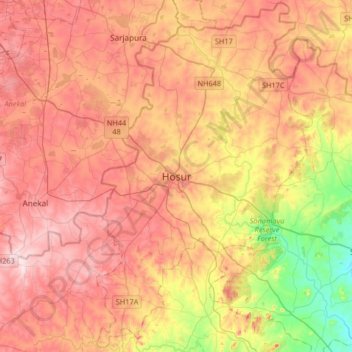
Naam: Topografische kaart Hosur, hoogte, reliëf.
Locatie: Hosur, Krishnagiri District, Tamil Nadu, 635109, India (12.57288 77.67095 12.89288 77.99095)
Gemiddelde hoogte: 859 m
Minimale hoogte: 695 m
Maximale hoogte: 982 m