
Topografische kaart Kent
Klik op de kaart om de hoogte weer te geven.
Kent
Located on the western end of the Glaciated Allegheny Plateau, the topography of Kent includes rolling hills and varied terrain. The Cuyahoga River passes through the city, cutting a gorge with a drop of nearly 40 feet (10 m) adjacent to the downtown area. The United States Geological Survey lists the city's elevation at 1,056 feet (322 m) above sea level at a point near Kent's geographic center. Elevations vary slightly within the city limits with several buildings on the Kent State University campus at altitudes in excess of 1,160 feet (350 m) and points as high as 1,200 feet (370 m). According to the United States Census Bureau, as of 2010 the city has a total area of 9.28 square miles (24.04 km2), of which 9.17 square miles (23.75 km2) is land and 0.11 square miles (0.28 km2) is water.
Over deze kaart
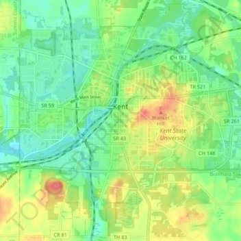
Naam: Topografische kaart Kent, hoogte, reliëf.
Locatie: Kent, Portage County, Ohio, United States (41.11765 -81.39246 41.17781 -81.30999)
Gemiddelde hoogte: 328 m
Minimale hoogte: 304 m
Maximale hoogte: 369 m
Andere topografische kaarten
Klik op een kaart om zijn topografie, zijn hoogte en zijn reliëf te bekijken.