
Topografische kaart Wilson
Interactieve kaart
Klik op de kaart om de hoogte weer te geven.
Over deze kaart
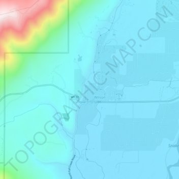
Naam: Topografische kaart Wilson, hoogte, reliëf.
Locatie: Wilson, Teton County, Wyoming, United States of America (43.48076 -110.89521 43.52076 -110.85521)
Gemiddelde hoogte: 1.953 m
Minimale hoogte: 1.866 m
Maximale hoogte: 2.573 m
Wilson is located at 43°29′11″N 110°52′45″W / 43.48639°N 110.87917°W / 43.48639; -110.87917 (43.4863, -110.8793). at an elevation of 6,148 feet (1,874 m) above sea level.