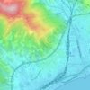
Topografische kaart Bormida
Klik op de kaart om de hoogte weer te geven.
Bormida
Bormida is about 20 kilometres (12 mi) west of Savona (as the crow flies) in the upper Val Bormida between the mountain peaks of Settepani, elevation 1,386 metres (4,547 ft), and Ronco di Maglio, elevation 1,108 metres (3,635 ft). The Bormida di Pallare, a tributary of the Bormida di Spigno, flows through its territory.
Over deze kaart

Naam: Topografische kaart Bormida, hoogte, reliëf.
Locatie: Bormida, Savona, Liguria, Italy (44.23772 8.19388 44.30136 8.26802)
Gemiddelde hoogte: 793 m
Minimale hoogte: 439 m
Maximale hoogte: 1.377 m
Andere topografische kaarten
Klik op een kaart om zijn topografie, zijn hoogte en zijn reliëf te bekijken.