
Topografische kaart Corral de Piedra
Interactieve kaart
Klik op de kaart om de hoogte weer te geven.
Over deze kaart
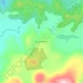
Naam: Topografische kaart Corral de Piedra, hoogte, reliëf.
Locatie: Corral de Piedra, Amanalco, Estado de México, México (19.19078 -99.98891 19.23078 -99.94891)
Gemiddelde hoogte: 2.925 m
Minimale hoogte: 2.718 m
Maximale hoogte: 3.317 m
Andere topografische kaarten
Klik op een kaart om zijn topografie, zijn hoogte en zijn reliëf te bekijken.
San Bartolo
México > Estado de México > Amanalco > Polvillos (San Bartolo 5ta Secc)
San Bartolo, Polvillos (San Bartolo 5ta Secc), Amanalco, Estado de México, 51207, México
Gemiddelde hoogte: 2.250 m