
Topografische kaart Eghlid
Interactieve kaart
Klik op de kaart om de hoogte weer te geven.
Eghlid
Eqlid is located 22 km west of the Expressway between Isfahan and Shiraz. The population of Eghlid is about 45,000 (2011). It is located close to the mountain chain Zagros and is one of the highest elevations (a mountain peak known as Bel) among Iran cities (2250 meters). It is also close to the desert city of Abarqu, making it a city in the border of high mountain and desert. It has a dry and cold weather, and some of its mountain peaks are covered by snow throughout the year. It is an agriculture city and its main products are wheat, barley, potato and fruits like grapes, walnut, apple, and pear. Its main road is Emam Khomeini Boulevard.
Over deze kaart
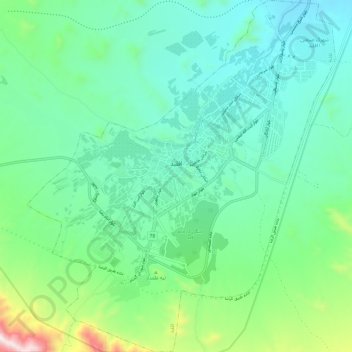
Naam: Topografische kaart Eghlid, hoogte, reliëf.
Gemiddelde hoogte: 2.310 m
Minimale hoogte: 2.115 m
Maximale hoogte: 2.984 m
Andere topografische kaarten
Klik op een kaart om zijn topografie, zijn hoogte en zijn reliëf te bekijken.