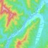
Topografische kaart Senapati
Klik op de kaart om de hoogte weer te geven.
Senapati
Senapati District is located between 93.29° and 94.15° East Longitude and 24.37° and 25.37° North Latitude and is in the northern part of Manipur state. The District is bounded on the south by Kangpokpi District, on the east by Ukhrul district, on the west by Tamenglong district and on the north by Kohima District and Phek district of Nagaland state. The district lies at an altitude between 1061 meter to 1788 meters above sea level.
Over deze kaart

Naam: Topografische kaart Senapati, hoogte, reliëf.
Locatie: Senapati, Manipur, India (25.16882 93.75872 25.61527 94.49164)
Gemiddelde hoogte: 1.454 m
Minimale hoogte: 323 m
Maximale hoogte: 2.996 m
Andere topografische kaarten
Klik op een kaart om zijn topografie, zijn hoogte en zijn reliëf te bekijken.