
Topografische kaart Pensacola
Interactieve kaart
Klik op de kaart om de hoogte weer te geven.
Over deze kaart
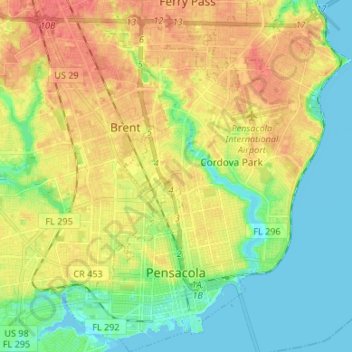
Naam: Topografische kaart Pensacola, hoogte, reliëf.
Gemiddelde hoogte: 21 m
Minimale hoogte: -3 m
Maximale hoogte: 46 m
The land is up sloping to the north from Pensacola Bay with most of the area having elevations above hurricane storm surge.