
Topografische kaart DeArmanville
Interactieve kaart
Klik op de kaart om de hoogte weer te geven.
Over deze kaart
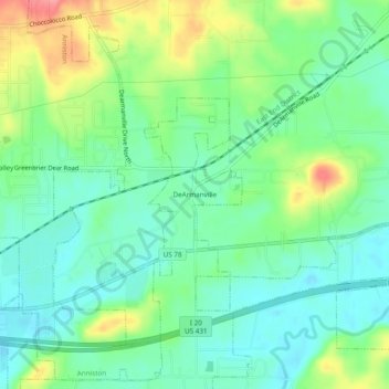
Naam: Topografische kaart DeArmanville, hoogte, reliëf.
Gemiddelde hoogte: 216 m
Minimale hoogte: 187 m
Maximale hoogte: 274 m
Andere topografische kaarten
Klik op een kaart om zijn topografie, zijn hoogte en zijn reliëf te bekijken.
Bynum
United States > Alabama > Calhoun County > Oxford
Bynum, Oxford, Calhoun County, Alabama, 36260, United States
Gemiddelde hoogte: 199 m
Knoxville
United States > Alabama > Calhoun County > Oxford
Knoxville, Oxford, Calhoun County, Alabama, United States
Gemiddelde hoogte: 220 m