
Topografische kaart Twentynine Palms
Interactieve kaart
Klik op de kaart om de hoogte weer te geven.
Twentynine Palms
According to the United States Census Bureau, the city has a total area of 59.1 square miles (153 km2), all land. The city is at an elevation of 1,988 feet (606 m). The Marine Corps Air Ground Combat Center Twentynine Palms is located there.
Over deze kaart
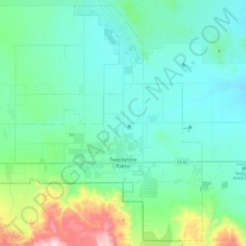
Naam: Topografische kaart Twentynine Palms, hoogte, reliëf.
Gemiddelde hoogte: 690 m
Minimale hoogte: 489 m
Maximale hoogte: 1.546 m