
Topografische kaart Cooch Behar
Interactieve kaart
Klik op de kaart om de hoogte weer te geven.
Over deze kaart
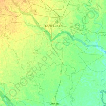
Naam: Topografische kaart Cooch Behar, hoogte, reliëf.
Locatie: Cooch Behar, Kochbihar, West Bengal, India (26.17501 89.26924 26.33511 89.56484)
Gemiddelde hoogte: 41 m
Minimale hoogte: 31 m
Maximale hoogte: 53 m
Cooch Behar is a flat region with a slight southeastern slope along which the main rivers of the district flow. Most of the highland areas are in the Sitalkuchi region, and most of the low-lying lands lie in Dinhata region. The elevation of the town is 48 meters above mean sea level. The Torsa river flows by the western side of town. The rivers in the district of Cooch Behar generally flow from northwest to southeast. Six rivers that cut through the district are the Teesta, Jaldhaka, Torsha, Kaljani, Raidak, Gadadhar, and Ghargharia.