
Topografische kaart Fox Creek
Interactieve kaart
Klik op de kaart om de hoogte weer te geven.
Fox Creek
Fox Creek is a town in northwest Alberta, Canada. It is located on Highway 43, approximately 259 km (161 mi) northwest of Edmonton and 199 km (124 mi) southeast of Grande Prairie, and has an elevation of 808 m (2,651 ft).
Over deze kaart
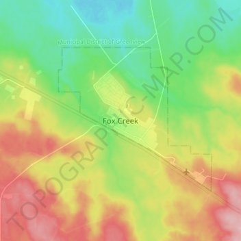
Naam: Topografische kaart Fox Creek, hoogte, reliëf.
Locatie: Fox Creek, Town of Fox Creek, Alberta, T0H 1P0, Canada (54.35721 -116.84338 54.43721 -116.76338)
Gemiddelde hoogte: 834 m
Minimale hoogte: 776 m
Maximale hoogte: 913 m