
Topografische kaart Mississippi River
Interactieve kaart
Klik op de kaart om de hoogte weer te geven.
Over deze kaart
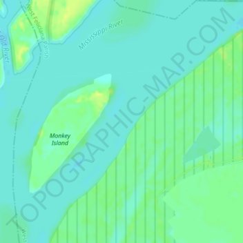
Naam: Topografische kaart Mississippi River, hoogte, reliëf.
Gemiddelde hoogte: 13 m
Minimale hoogte: 7 m
Maximale hoogte: 24 m
The uppermost lock and dam on the Upper Mississippi River is the Upper St. Anthony Falls Lock and Dam in Minneapolis. Above the dam, the river's elevation is 799 feet (244 m). Below the dam, the river's elevation is 750 feet (230 m). This 49-foot (15 m) drop is the largest of all the Mississippi River locks and dams. The origin of the dramatic drop is a waterfall preserved adjacent to the lock under an apron of concrete. Saint Anthony Falls is the only true waterfall on the entire Mississippi River. The water elevation continues to drop steeply as it passes through the gorge carved by the waterfall.
Andere topografische kaarten
Klik op een kaart om zijn topografie, zijn hoogte en zijn reliëf te bekijken.
Tunica Hills
United States > Louisiana > West Feliciana Parish
Tunica Hills, West Feliciana Parish, Louisiana, 70782, United States
Gemiddelde hoogte: 53 m
St. Francisville
United States > Louisiana > West Feliciana Parish
St. Francisville, West Feliciana Parish, Louisiana, United States
Gemiddelde hoogte: 39 m