
Topografische kaart Abbot Pass Hut
Interactieve kaart
Klik op de kaart om de hoogte weer te geven.
Abbot Pass Hut
The approach via Lake O'Hara is by far the most popular route into the hut. It is safer and less technical than going in via the Deathtrap or the Fuhrmann Ledges. It involves about 900 metres (3,000 feet) of elevation gain and 3 to 5+ hours from Lake O'Hara to the hut depending on conditions and the strength of the party. People should not automatically assume they can always get to the hut, since some groups have been caught out overnight on the trail or stranded at the hut in bad weather conditions.
Over deze kaart
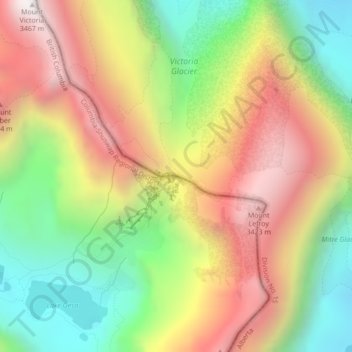
Naam: Topografische kaart Abbot Pass Hut, hoogte, reliëf.
Gemiddelde hoogte: 2.789 m
Minimale hoogte: 2.186 m
Maximale hoogte: 3.444 m