
Topografische kaart Santa Úrsula Zimatepec
Interactieve kaart
Klik op de kaart om de hoogte weer te geven.
Over deze kaart
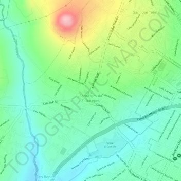
Naam: Topografische kaart Santa Úrsula Zimatepec, hoogte, reliëf.
Locatie: Santa Úrsula Zimatepec, Yauhquemehcan, Tlaxcala, México (19.41007 -98.17491 19.43037 -98.15402)
Gemiddelde hoogte: 2.433 m
Minimale hoogte: 2.371 m
Maximale hoogte: 2.553 m