
Topografische kaart Kochi
Interactieve kaart
Klik op de kaart om de hoogte weer te geven.
Over deze kaart
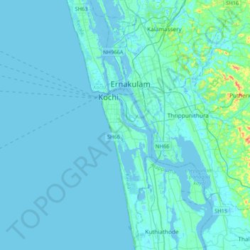
Naam: Topografische kaart Kochi, hoogte, reliëf.
Locatie: Kochi, Ernakulam district, Kerala, 682005, India (9.77137 76.10738 10.09137 76.42738)
Gemiddelde hoogte: 5 m
Minimale hoogte: -4 m
Maximale hoogte: 75 m
Andere topografische kaarten
Klik op een kaart om zijn topografie, zijn hoogte en zijn reliëf te bekijken.
Willingdon Island
India > Kerala > Kochi > Kochi
Willingdon Island, Kochi, Ernakulam District, Kerala, India
Gemiddelde hoogte: 4 m
Kumbalanghi
India > Kerala > Kochi > Kochi
Kumbalanghi, Kochi, Ernakulam district, Kerala, 682007, India
Gemiddelde hoogte: 3 m