Geolokaliseren

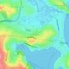
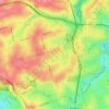
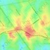
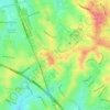
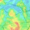
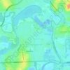
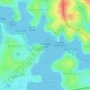
Topografische kaart Reg Coady Reserve

Klik op de kaart om de hoogte weer te geven.

Over deze kaart

Naam: Topografische kaart Reg Coady Reserve, hoogte, reliëf.

Locatie: Reg Coady Reserve, Haberfield, Sydney, Inner West Council, New South Wales, 2045, Australia (-33.87426 151.13302 -33.87299 151.13737)

Gemiddelde hoogte: 14 m

Minimale hoogte: -3 m

Maximale hoogte: 39 m

Andere topografische kaarten

Klik op een kaart om zijn topografie, zijn hoogte en zijn reliëf te bekijken.
Penrith

Australia > New South Wales > Sydney > Penrith

Penrith is a city in New South Wales, Australia, located in Greater Western Sydney, 55 kilometres (31 mi) west of the Sydney central business district on the banks of the Nepean River, on the outskirts of the Cumberland Plain. Its elevation is 32 metres (105 ft).

Gemiddelde hoogte: 34 m
Sydney

Australia > New South Wales > Sydney

Gemiddelde hoogte: 23 m

Camden Council

Australia > New South Wales > Sydney

Gemiddelde hoogte: 90 m

St Ives

Australia > New South Wales > Sydney

Gemiddelde hoogte: 125 m

Hornsby

Australia > New South Wales > Sydney

Gemiddelde hoogte: 160 m

Kenthurst

Australia > New South Wales > Sydney

Gemiddelde hoogte: 100 m

Fairlight

Australia > New South Wales > Sydney

Gemiddelde hoogte: 23 m

Northern Beaches

Australia > New South Wales > Sydney

Gemiddelde hoogte: 67 m

Mosman

Australia > New South Wales > Sydney

Gemiddelde hoogte: 29 m

McMahons Point

Australia > New South Wales > Sydney

Gemiddelde hoogte: 23 m

Botany Bay

Australia > New South Wales > Sydney

Gemiddelde hoogte: 8 m

Epping

Australia > New South Wales > Sydney

Gemiddelde hoogte: 96 m

Ryde

Australia > New South Wales > Sydney

Gemiddelde hoogte: 52 m

Inner West

Australia > New South Wales > Sydney

Gemiddelde hoogte: 19 m

Bondi Beach

Australia > New South Wales > Sydney

Gemiddelde hoogte: 31 m

Inner West

Australia > New South Wales > Sydney

Gemiddelde hoogte: 19 m

Hurstville

Australia > New South Wales > Sydney

Gemiddelde hoogte: 50 m

Liverpool

Australia > New South Wales > Sydney

Gemiddelde hoogte: 14 m

Belrose

Australia > New South Wales > Sydney

Gemiddelde hoogte: 124 m

Engadine

Australia > New South Wales > Sydney

Gemiddelde hoogte: 121 m
Hurlstone Park

Australia > New South Wales > Sydney

Gemiddelde hoogte: 24 m

Cheltenham

Australia > New South Wales > Sydney

Gemiddelde hoogte: 105 m

Blues Point

Australia > New South Wales > Sydney

Gemiddelde hoogte: 15 m

Annandale

Australia > New South Wales > Sydney

Gemiddelde hoogte: 24 m

Cronulla

Australia > New South Wales > Sydney

Gemiddelde hoogte: 8 m

Chowder Bay

Australia > New South Wales > Sydney

Gemiddelde hoogte: 24 m

Bella Vista

Australia > New South Wales > Sydney

Gemiddelde hoogte: 79 m

Peak Hill

Australia > New South Wales > Sydney

Gemiddelde hoogte: 58 m

Darlinghurst

Australia > New South Wales > Sydney

Gemiddelde hoogte: 38 m

Killara

Australia > New South Wales > Sydney

Gemiddelde hoogte: 86 m

Glebe

Australia > New South Wales > Sydney

Gemiddelde hoogte: 18 m

Newtown

Australia > New South Wales > Sydney

Gemiddelde hoogte: 22 m

Holsworthy

Australia > New South Wales > Sydney

Gemiddelde hoogte: 121 m

Dee Why

Australia > New South Wales > Sydney

Gemiddelde hoogte: 31 m

Allambie Heights

Australia > New South Wales > Sydney

Gemiddelde hoogte: 77 m

Balgowlah Heights

Australia > New South Wales > Sydney

Gemiddelde hoogte: 25 m

Wentworth Falls

Australia > New South Wales > Sydney

Wentworth Falls (postcode: 2782) is a town in the Blue Mountains region of New South Wales, situated approximately 100 kilometres (62 mi) west of the Sydney central business district, and about 8 kilometres (5.0 mi) east of Katoomba, Australia on the Great Western Highway, with a Wentworth Falls railway…

Gemiddelde hoogte: 708 m
Marrickville

Australia > New South Wales > Sydney

Gemiddelde hoogte: 17 m

Camp Cove

Australia > New South Wales > Sydney

Gemiddelde hoogte: 5 m

Alexandria

Australia > New South Wales > Sydney

Gemiddelde hoogte: 17 m

Lane Cove National Park

Australia > New South Wales > Sydney

The park includes areas of land which are part of Ku-ring-gai, Ryde, and Hornsby local government areas with small areas of the park in Willoughby, Lane Cove and Hunter's Hill local government areas on the banks of the lower reaches of the river. The park is surrounded on all sides by developed suburban areas…

Gemiddelde hoogte: 81 m

Blacktown

Australia > New South Wales > Sydney

Gemiddelde hoogte: 57 m

Milperra

Australia > New South Wales > Sydney

Gemiddelde hoogte: 8 m

Padstow Heights

Australia > New South Wales > Sydney

Gemiddelde hoogte: 26 m

Lugarno

Australia > New South Wales > Sydney

Gemiddelde hoogte: 28 m

Lower North Shore

Australia > New South Wales > Sydney

Gemiddelde hoogte: 45 m

Glen Alpine

Australia > New South Wales > Sydney

Gemiddelde hoogte: 116 m

Ebenezer

Australia > New South Wales > Sydney

Gemiddelde hoogte: 25 m

Sutherland Shire

Australia > New South Wales > Sydney

Gemiddelde hoogte: 79 m

Eastern Suburbs

Australia > New South Wales > Sydney

Gemiddelde hoogte: 12 m

Dobroyd Head

Australia > New South Wales > Sydney

Gemiddelde hoogte: 16 m

Hunters Hill

Australia > New South Wales > Sydney

Gemiddelde hoogte: 24 m

Chipping Norton

Australia > New South Wales > Sydney

Gemiddelde hoogte: 9 m

Middle Head

Australia > New South Wales > Sydney

Gemiddelde hoogte: 9 m

Enmore

Australia > New South Wales > Sydney

Gemiddelde hoogte: 23 m

Darling Point

Australia > New South Wales > Sydney

Gemiddelde hoogte: 23 m

Emu Heights

Australia > New South Wales > Sydney

Gemiddelde hoogte: 87 m

Cabarita Point

Australia > New South Wales > Sydney

Gemiddelde hoogte: 12 m

Cremorne Point

Australia > New South Wales > Sydney

Gemiddelde hoogte: 29 m

Edensor Park

Australia > New South Wales > Sydney

Gemiddelde hoogte: 57 m

Inner West Council

Australia > New South Wales > Sydney

Gemiddelde hoogte: 19 m

Mount Lewis

Australia > New South Wales > Sydney

Gemiddelde hoogte: 39 m

North Head

Australia > New South Wales > Sydney

Gemiddelde hoogte: 22 m

Scotland Island

Australia > New South Wales > Sydney

Gemiddelde hoogte: 17 m

Woodford

Australia > New South Wales > Sydney

Woodford is a village in the Blue Mountains in New South Wales, Australia, about 90 kilometres west of Sydney. Its elevation is 609 metres (1,998 ft) above sea level. It is situated on the Great Western Highway and has a railway station (opened in 1868 as Buss's Platform) on the Main Western railway line…

Gemiddelde hoogte: 544 m
Rockdale

Australia > New South Wales > Sydney

Gemiddelde hoogte: 20 m

Waverton

Australia > New South Wales > Sydney

Gemiddelde hoogte: 33 m

Berkshire Park

Australia > New South Wales > Sydney

Gemiddelde hoogte: 27 m

St Leonards

Australia > New South Wales > Sydney

Gemiddelde hoogte: 69 m

Denistone West

Australia > New South Wales > Sydney

Gemiddelde hoogte: 55 m

Parsley Bay

Australia > New South Wales > Sydney > Brooklyn

Gemiddelde hoogte: 20 m

Nelson

Australia > New South Wales > Sydney

Gemiddelde hoogte: 47 m

Beaconsfield

Australia > New South Wales > Sydney

Gemiddelde hoogte: 18 m

Smithfield

Australia > New South Wales > Sydney

Established in 1836, Smithfield was the first major settlement of the Fairfield LGA. The original 1838 summary plan of Smithfield shows the suburb laid out in a grid pattern with most of the streets having the same names as they do today. Its altitude ranges from 21 to 48 m (69 to 157 ft) above sea level.…

Gemiddelde hoogte: 33 m

Cronulla Point

Australia > New South Wales > Sydney

Gemiddelde hoogte: 7 m

Holroyd

Australia > New South Wales > Sydney

Gemiddelde hoogte: 24 m

Richmond Lowlands

Australia > New South Wales > Sydney

Gemiddelde hoogte: 13 m

Oyster Bay

Australia > New South Wales > Sydney

Gemiddelde hoogte: 25 m

Killarney Heights

Australia > New South Wales > Sydney

Gemiddelde hoogte: 72 m

North Curl Curl

Australia > New South Wales > Sydney

Gemiddelde hoogte: 22 m

Macquarie Park

Australia > New South Wales > Sydney

Gemiddelde hoogte: 59 m

Sans Souci

Australia > New South Wales > Sydney

Gemiddelde hoogte: 4 m

Carlingford

Australia > New South Wales > Sydney

Gemiddelde hoogte: 98 m

Galston

Australia > New South Wales > Sydney

Gemiddelde hoogte: 167 m

Marsfield

Australia > New South Wales > Sydney

Gemiddelde hoogte: 72 m

Gregory Hills

Australia > New South Wales > Sydney

Gregory Hills is a suburb of Sydney in the state of New South Wales, Australia in Camden Council. The suburb was assigned on 1 August 2008. The suburb was named from the topography of the local area and from the original St Gregory's Chapel on the Marist Brothers land.

Gemiddelde hoogte: 109 m
Oran Park

Australia > New South Wales > Sydney

Gemiddelde hoogte: 93 m

Schofields

Australia > New South Wales > Sydney

Gemiddelde hoogte: 32 m

Moorebank

Australia > New South Wales > Sydney

Gemiddelde hoogte: 12 m

Greystanes

Australia > New South Wales > Sydney

Gemiddelde hoogte: 53 m

Cammeray

Australia > New South Wales > Sydney

Prior to the 1920s, the suburb was known as Suspension Bridge reflecting the now Long Gully Bridge that joined Northbridge to Cammeray. Cammeray was slow to develop mainly due to its steep topography and remoteness from transport.

Gemiddelde hoogte: 66 m
Bringelly

Australia > New South Wales > Sydney

Gemiddelde hoogte: 87 m

Rust jezelf uit voor je volgende avontuur:

🗺️Fysieke Kaarten België - De perfecte aanvulling op digitale topografie
👖Wandelbroeken - Sneldrogende en slijtvaste broeken voor outdoor
👕Merino Wollen Shirts - Natuurlijke geurbestrijding en temperatuurregeling
🧰Outdoor Multitools - Compacte tools voor elke situatie
🔦Hoofdlampen - Handsfree verlichting voor nachtelijke wandelingen

Als Amazon-partner verdient deze site een commissie op in aanmerking komende aankopen, zonder extra kosten voor jou.