Topografische kaart Udaipur
Klik op de kaart om de hoogte weer te geven.
Udaipur
Udaipur is located at 24°31′30″N 73°40′38″E / 24.525049°N 73.677116°E / 24.525049; 73.677116. The city covers an area of 64 km2 (25 sq mi) and lies at an altitude of 598.00 m (1,962 ft) above sea level. It is located in the southern region of Rajasthan, near the Gujarat border. The city lies 403 km (250 mi) southwest of the state capital, Jaipur and 250 km (155 mi) northeast from Ahmedabad.
Over deze kaart
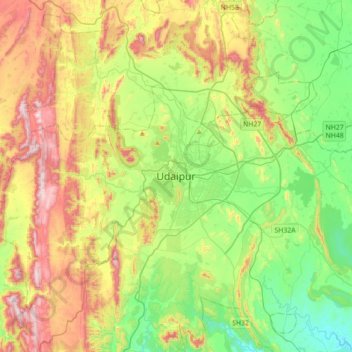
Naam: Topografische kaart Udaipur, hoogte, reliëf.
Locatie: Udaipur, Girwa Tehsil, Udaipur, Rajasthan, 313001, India (24.41872 73.52626 24.73872 73.84626)
Gemiddelde hoogte: 656 m
Minimale hoogte: 408 m
Maximale hoogte: 1.067 m
Andere topografische kaarten
Klik op een kaart om zijn topografie, zijn hoogte en zijn reliëf te bekijken.