Geolokaliseren

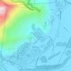
Topografische kaart Malanda

Klik op de kaart om de hoogte weer te geven.

Over deze kaart

Naam: Topografische kaart Malanda, hoogte, reliëf.

Locatie: Malanda, Tablelands Regional, Queensland, Australia (-17.39284 145.55594 -17.31284 145.63594)

Gemiddelde hoogte: 744 m

Minimale hoogte: 688 m

Maximale hoogte: 830 m

Andere topografische kaarten

Klik op een kaart om zijn topografie, zijn hoogte en zijn reliëf te bekijken.

Urraween

Australia > Queensland > Hervey Bay

Gemiddelde hoogte: 23 m

Sunshine Coast Regional

Australia > Queensland

The Sunshine Coast Regional area in Queensland, Australia, features a diverse topography that ranges from coastal plains to rugged hinterlands. Along the coastline, the terrain is predominantly flat, with average elevations around 20 meters (66 feet) above sea level. Inland, the landscape transitions to…

Gemiddelde hoogte: 56 m
Sippy Downs

Australia > Queensland

Gemiddelde hoogte: 12 m

Robina

Australia > Queensland

Gemiddelde hoogte: 8 m

City of Brisbane

Australia > Queensland

Brisbane's topography is characterized by a series of hills and ranges that define its landscape. The city is situated on a low-lying floodplain, with the Brisbane River meandering through its heart, creating a winding course with many steep curves from the southwest to its mouth at Moreton Bay in the east.…

Gemiddelde hoogte: 71 m
Brisbane

Australia > Queensland

Gemiddelde hoogte: 87 m

Coochiemudlo Island

Australia > Queensland

Gemiddelde hoogte: 2 m

Mount Coot-tha

Australia > Queensland > City of Brisbane

It is often claimed that Mount Coot-tha is the "highest point in Brisbane", but, as the elevations above show, the peak known as Mount Coot-tha is not even the highest peak of the mountain as a whole with both Constitution Hill and The Summit being higher. However, Mount Coot-tha has a lookout with unobscured…

Gemiddelde hoogte: 88 m

Kelso

Australia > Queensland

Gemiddelde hoogte: 30 m

Burpengary

Australia > Queensland

Gemiddelde hoogte: 26 m

Palm Cove

Australia > Queensland

Gemiddelde hoogte: 46 m

Advancetown

Australia > Queensland

Gemiddelde hoogte: 170 m

South Coast

Australia > Queensland

Gemiddelde hoogte: 109 m

Cracow

Australia > Queensland

Gemiddelde hoogte: 316 m

Gold Coast City

Australia > Queensland

Gemiddelde hoogte: 87 m

Selwyn

Australia > Queensland

Gemiddelde hoogte: 284 m

Mount Lofty

Australia > Queensland > Toowoomba

Gemiddelde hoogte: 567 m

D'Aguilar National Park

Australia > Queensland

Gemiddelde hoogte: 139 m

Tingalpa Reservoir

Australia > Queensland

Gemiddelde hoogte: 26 m

Caravonica

Australia > Queensland > Cairns

Gemiddelde hoogte: 91 m

Porcupine

Australia > Queensland

Gemiddelde hoogte: 637 m

Tanawha

Australia > Queensland > Sunshine Coast

Gemiddelde hoogte: 41 m

Daintree Rainforest

Australia > Queensland

Gemiddelde hoogte: 59 m

Wivenhoe Dam

Australia > Queensland

Gemiddelde hoogte: 62 m

Scenic Rim Regional

Australia > Queensland

Gemiddelde hoogte: 261 m

Wynnum West

Australia > Queensland

Gemiddelde hoogte: 15 m

Camp Hill

Australia > Queensland > Brisbane

Gemiddelde hoogte: 37 m

South Burnett Regional

Australia > Queensland

Gemiddelde hoogte: 389 m

Anduramba

Australia > Queensland > Anduramba

Gemiddelde hoogte: 407 m

Bannockburn

Australia > Queensland

Gemiddelde hoogte: 30 m

Woolloongabba

Australia > Queensland

Gemiddelde hoogte: 18 m

Warwick

Australia > Queensland

Warwick experiences an altitude-influenced humid subtropical climate (Köppen: Cfa), with hot summers and mild, relatively dry winters with cold nights. Annual precipitation averages 662.4 millimetres (26.08 in), with a summer maximum. The town is slightly cooler and less humid than the proximate southeast…

Gemiddelde hoogte: 474 m

Woorim

Australia > Queensland

Gemiddelde hoogte: 3 m

Beenleigh

Australia > Queensland

Gemiddelde hoogte: 22 m

Taroom

Australia > Queensland

Gemiddelde hoogte: 232 m

Tuchekoi

Australia > Queensland

Gemiddelde hoogte: 99 m

Lake Macdonald

Australia > Queensland

Gemiddelde hoogte: 95 m

Burrum Heads

Australia > Queensland

Gemiddelde hoogte: 6 m

Bucca

Australia > Queensland

Gemiddelde hoogte: 45 m

Baffle Creek

Australia > Queensland

Gemiddelde hoogte: 81 m

Brisbane River

Australia > Queensland

The RAAF also perform a practice session in the days preceding the event, serving as an opportunity to both practice beforehand and also promote Riverfire. One of the most popular RAAF aircraft to perform at Riverfire was the F-111 which was known for performing a 'dump-and-burn' above the city. The final…

Gemiddelde hoogte: 235 m
Logan City

Australia > Queensland

Gemiddelde hoogte: 61 m

Albany Creek

Australia > Queensland

Gemiddelde hoogte: 37 m

Lockyer Valley Regional

Australia > Queensland

Gemiddelde hoogte: 360 m

Deception Bay

Australia > Queensland

Gemiddelde hoogte: 9 m

Ballandean

Australia > Queensland

Gemiddelde hoogte: 830 m

Boodua

Australia > Queensland

Gemiddelde hoogte: 448 m

Joyner

Australia > Queensland

Gemiddelde hoogte: 31 m

The Caves

Australia > Queensland

Gemiddelde hoogte: 61 m

Ravenswood

Australia > Queensland

Gemiddelde hoogte: 222 m

Collinsville

Australia > Queensland

Gemiddelde hoogte: 197 m

Coomera

Australia > Queensland > Gold Coast City

Gemiddelde hoogte: 13 m

Main Range National Park

Australia > Queensland

Gemiddelde hoogte: 537 m

Pallara Park

Australia > Queensland

Gemiddelde hoogte: 21 m

Sundown National Park

Australia > Queensland

Gemiddelde hoogte: 787 m

Thanes Creek

Australia > Queensland

Gemiddelde hoogte: 498 m

Abergowrie

Australia > Queensland

Gemiddelde hoogte: 270 m

Bloomsbury

Australia > Queensland

Gemiddelde hoogte: 140 m

Moreton Bay Regional

Australia > Queensland

Gemiddelde hoogte: 110 m

Chelmer

Australia > Queensland

Gemiddelde hoogte: 18 m

Cranbrook

Australia > Queensland

Gemiddelde hoogte: 15 m

Bracken Ridge

Australia > Queensland

Gemiddelde hoogte: 13 m

St Lucia

Australia > Queensland

Gemiddelde hoogte: 18 m

St Lawrence

Australia > Queensland

Gemiddelde hoogte: 139 m

Kingston

Australia > Queensland

Gemiddelde hoogte: 22 m

Oxley

Australia > Queensland > Logan City

Gemiddelde hoogte: 23 m

Park Ridge

Australia > Queensland

Gemiddelde hoogte: 39 m

Cow Bay

Australia > Queensland

Gemiddelde hoogte: 45 m

Chatsworth

Australia > Queensland

Gemiddelde hoogte: 107 m

Sunrise Beach

Australia > Queensland

Gemiddelde hoogte: 17 m

Kallangur

Australia > Queensland

Gemiddelde hoogte: 28 m

Molendinar

Australia > Queensland > Gold Coast City

Gemiddelde hoogte: 27 m

Scarborough

Australia > Queensland

Gemiddelde hoogte: 4 m

Kingaroy

Australia > Queensland

Gemiddelde hoogte: 468 m

Roma

Australia > Queensland

Roma experiences a humid subtropical climate (Köppen: Cfa, Trewartha: Cfal); with hot summers with moderate rains; warm to hot, relatively dry springs and autumns; and mild, dry winters. Its location on the far south of the Carnarvon Range at an elevation of 299 metres above sea level means that it is cooler…

Gemiddelde hoogte: 315 m

Herberton

Australia > Queensland > Herberton

Gemiddelde hoogte: 946 m

Maryborough

Australia > Queensland

Gemiddelde hoogte: 14 m

Gatton

Australia > Queensland

The area has a humid subtropical climate, with hot, humid summers and mild, sunny winters, albeit with cool nights. Heavy summer rain and warm conditions have provided ideal conditions for the areas agricultural productivity, although droughts and heatwaves can be problematic at times. Temperatures in Gatton…

Gemiddelde hoogte: 118 m

Bellthorpe

Australia > Queensland

Gemiddelde hoogte: 375 m

Petrie Terrace

Australia > Queensland

Gemiddelde hoogte: 27 m

Thangool

Australia > Queensland

Gemiddelde hoogte: 315 m

Mutchilba

Australia > Queensland

Gemiddelde hoogte: 612 m

Meston Ridge

Australia > Queensland

Gemiddelde hoogte: 921 m

Goldfields

Australia > Queensland

Gemiddelde hoogte: 711 m

Wyaralong Dam

Australia > Queensland

Gemiddelde hoogte: 71 m

Dirranbandi

Australia > Queensland

Gemiddelde hoogte: 176 m

Tolga

Australia > Queensland

Gemiddelde hoogte: 699 m

Coochiemudlo Island

Australia > Queensland

Gemiddelde hoogte: 2 m

Aloomba

Australia > Queensland

Gemiddelde hoogte: 233 m

Borallon

Australia > Queensland

Gemiddelde hoogte: 45 m

England Creek

Australia > Queensland

Gemiddelde hoogte: 190 m

Oontoo Waterhole

Australia > Queensland

Gemiddelde hoogte: 57 m

Toolakea

Australia > Queensland

Gemiddelde hoogte: 3 m

Hargreaves Road Park

Australia > Queensland

Gemiddelde hoogte: 18 m

Habana

Australia > Queensland

Gemiddelde hoogte: 31 m

Glenfern

Australia > Queensland

Gemiddelde hoogte: 124 m

Alice River

Australia > Queensland

Gemiddelde hoogte: 68 m

Gilbert River

Australia > Queensland

Gemiddelde hoogte: 202 m

Rust jezelf uit voor je volgende avontuur:

🔦Hoofdlampen - Handsfree verlichting voor wandelingen bij schemering
🧤Outdoor Handschoenen - Bescherming tegen kou en wind tijdens hikes
👕Merino Wollen Shirts - Natuurlijke geurbestrijding en temperatuurregeling
🧦Wandelsokken - Voorkom blaren tijdens lange tochten door de Ardennen
🪑Picknickdekens - Comfortabel zitten op gras of zand

Als Amazon-partner verdient deze site een commissie op in aanmerking komende aankopen, zonder extra kosten voor jou.