
Topografische kaart Le Grand Hameau
Interactieve kaart
Klik op de kaart om de hoogte weer te geven.
Over deze kaart
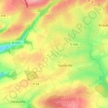
Naam: Topografische kaart Le Grand Hameau, hoogte, reliëf.
Gemiddelde hoogte: 103 m
Minimale hoogte: 43 m
Maximale hoogte: 151 m
Andere topografische kaarten
Klik op een kaart om zijn topografie, zijn hoogte en zijn reliëf te bekijken.
Hameau Fabien
France > Normandie > Manche > La Hague > Vasteville
Hameau Fabien, Vasteville, La Hague, Cherbourg, Manche, Normandie, France métropolitaine, 50440, France
Gemiddelde hoogte: 102 m