Geolokaliseren

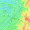
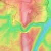
Topografische kaart Percy Park

Klik op de kaart om de hoogte weer te geven.

Over deze kaart

Naam: Topografische kaart Percy Park, hoogte, reliëf.

Locatie: Percy Park, Fairfield Heights, Sydney, Fairfield City Council, New South Wales, 2165, Australia (-33.86641 150.93361 -33.86602 150.93405)

Gemiddelde hoogte: 28 m

Minimale hoogte: 9 m

Maximale hoogte: 56 m

Andere topografische kaarten

Klik op een kaart om zijn topografie, zijn hoogte en zijn reliëf te bekijken.

Lindfield

Australia > New South Wales > Sydney

Gemiddelde hoogte: 79 m

Wentworth Falls

Australia > New South Wales > Sydney

Wentworth Falls (postcode: 2782) is a town in the Blue Mountains region of New South Wales, situated approximately 100 kilometres (62 mi) west of the Sydney central business district, and about 8 kilometres (5.0 mi) east of Katoomba, Australia on the Great Western Highway, with a Wentworth Falls railway…

Gemiddelde hoogte: 708 m
Ryde

Australia > New South Wales > Sydney

Gemiddelde hoogte: 52 m

Northern Beaches

Australia > New South Wales > Sydney

Gemiddelde hoogte: 67 m

Lower North Shore

Australia > New South Wales > Sydney

Gemiddelde hoogte: 45 m

Randwick

Australia > New South Wales > Sydney

Gemiddelde hoogte: 44 m

Liverpool

Australia > New South Wales > Sydney

Gemiddelde hoogte: 14 m

Rouse Hill

Australia > New South Wales > Sydney

Gemiddelde hoogte: 51 m

Mascot

Australia > New South Wales > Sydney

Gemiddelde hoogte: 8 m

Pitt Town

Australia > New South Wales > Sydney

Gemiddelde hoogte: 19 m

Mount Kuring-Gai

Australia > New South Wales > Sydney

Mount Kuring-gai is located approximately 7 km north of Hornsby. Its neighbouring suburbs are Berowra to the north, and Mount Colah to the south. Surrounded by bushland, it is bordered by Ku-ring-gai Chase National Park on the eastern side and by Berowra Valley Regional Park on the western side. There are…

Gemiddelde hoogte: 133 m
Sydney

Australia > New South Wales > Sydney

Gemiddelde hoogte: 23 m

Upper North Shore

Australia > New South Wales > Sydney

Gemiddelde hoogte: 119 m

Baulkham Hills

Australia > New South Wales > Sydney

Gemiddelde hoogte: 93 m

Crows Nest

Australia > New South Wales > Sydney

Gemiddelde hoogte: 68 m

Eastwood

Australia > New South Wales > Sydney

Gemiddelde hoogte: 80 m

Northbridge

Australia > New South Wales > Sydney

Gemiddelde hoogte: 53 m

Cronulla

Australia > New South Wales > Sydney

Gemiddelde hoogte: 8 m

Bondi Junction

Australia > New South Wales > Sydney

Gemiddelde hoogte: 63 m

Dolls Point

Australia > New South Wales > Sydney

Gemiddelde hoogte: 3 m

Eastern Suburbs

Australia > New South Wales > Sydney

Gemiddelde hoogte: 12 m

Minto

Australia > New South Wales > Sydney

Gemiddelde hoogte: 72 m

Sylvania

Australia > New South Wales > Sydney

Gemiddelde hoogte: 19 m

Penrith

Australia > New South Wales > Sydney > Penrith

Penrith is a city in New South Wales, Australia, located in Greater Western Sydney, 55 kilometres (31 mi) west of the Sydney central business district on the banks of the Nepean River, on the outskirts of the Cumberland Plain. Its elevation is 32 metres (105 ft).

Gemiddelde hoogte: 34 m
St Ives

Australia > New South Wales > Sydney

Gemiddelde hoogte: 125 m

Hornsby Heights

Australia > New South Wales > Sydney

Gemiddelde hoogte: 146 m

Engadine

Australia > New South Wales > Sydney

Gemiddelde hoogte: 121 m

Marrickville

Australia > New South Wales > Sydney

Gemiddelde hoogte: 17 m

Hornsby

Australia > New South Wales > Sydney

Gemiddelde hoogte: 160 m

Blackwattle Bay

Australia > New South Wales > Sydney

Gemiddelde hoogte: 15 m

Menangle Park

Australia > New South Wales > Sydney

Gemiddelde hoogte: 92 m

Willoughby

Australia > New South Wales > Sydney

Gemiddelde hoogte: 80 m

Waterfall

Australia > New South Wales > Sydney

Gemiddelde hoogte: 178 m

North Wahroonga

Australia > New South Wales > Sydney

Gemiddelde hoogte: 146 m

St George

Australia > New South Wales > Sydney

Gemiddelde hoogte: 25 m

Erskineville

Australia > New South Wales > Sydney

Gemiddelde hoogte: 21 m

Mosman Bay

Australia > New South Wales > Sydney

Gemiddelde hoogte: 41 m

Denistone East

Australia > New South Wales > Sydney

Gemiddelde hoogte: 66 m

Whipbird Gully

Australia > New South Wales > Sydney

Gemiddelde hoogte: 111 m

Bella Vista

Australia > New South Wales > Sydney

Gemiddelde hoogte: 79 m

Peak Hill

Australia > New South Wales > Sydney

Gemiddelde hoogte: 58 m

Smithfield

Australia > New South Wales > Sydney

Established in 1836, Smithfield was the first major settlement of the Fairfield LGA. The original 1838 summary plan of Smithfield shows the suburb laid out in a grid pattern with most of the streets having the same names as they do today. Its altitude ranges from 21 to 48 m (69 to 157 ft) above sea level.…

Gemiddelde hoogte: 33 m

Holroyd

Australia > New South Wales > Sydney

Gemiddelde hoogte: 24 m

Killarney Heights

Australia > New South Wales > Sydney

Gemiddelde hoogte: 72 m

North Curl Curl

Australia > New South Wales > Sydney

Gemiddelde hoogte: 22 m

Macquarie Park

Australia > New South Wales > Sydney

Gemiddelde hoogte: 59 m

Galston

Australia > New South Wales > Sydney

Gemiddelde hoogte: 167 m

Marsfield

Australia > New South Wales > Sydney

Gemiddelde hoogte: 72 m

Leichhardt

Australia > New South Wales > Sydney

Gemiddelde hoogte: 22 m

Gladesville

Australia > New South Wales > Sydney

Gemiddelde hoogte: 28 m

Putney

Australia > New South Wales > Sydney

Gemiddelde hoogte: 18 m

Mount Pritchard

Australia > New South Wales > Sydney

Gemiddelde hoogte: 34 m
Toongabbie

Australia > New South Wales > Sydney

Gemiddelde hoogte: 43 m

Kronos Hill

Australia > New South Wales > Sydney

Gemiddelde hoogte: 9 m

Epping

Australia > New South Wales > Sydney

Gemiddelde hoogte: 96 m

Bellevue Hill

Australia > New South Wales > Sydney

Gemiddelde hoogte: 36 m

Centennial Park

Australia > New South Wales > Sydney

Gemiddelde hoogte: 51 m

Neutral Bay

Australia > New South Wales > Sydney

Gemiddelde hoogte: 53 m

Casula

Australia > New South Wales > Sydney

Casula is the first suburb immediately south of Liverpool on the Hume Highway and the Main Southern railway line between Sydney and Melbourne. Casula consists of undulating, gently rolling land, with elevations across the suburb being mostly between 30 and 70 metres above sea level. The Georges River forms the…

Gemiddelde hoogte: 34 m
North Sydney

Australia > New South Wales > Sydney

Gemiddelde hoogte: 50 m

Lane Cove National Park

Australia > New South Wales > Sydney

The park includes areas of land which are part of Ku-ring-gai, Ryde, and Hornsby local government areas with small areas of the park in Willoughby, Lane Cove and Hunter's Hill local government areas on the banks of the lower reaches of the river. The park is surrounded on all sides by developed suburban areas…

Gemiddelde hoogte: 81 m

Cockatoo Island

Australia > New South Wales > Sydney

Gemiddelde hoogte: 46 m

Ingleburn

Australia > New South Wales > Sydney

Gemiddelde hoogte: 56 m

Ku-ring-gai Chase National Park

Australia > New South Wales > Sydney

Ku-ring-gai Chase is part of the Hornsby Plateau, a massive block of sandstone tilting upwards to the north. The park comprises a plateau with an elevation of generally 150–200 m above sea level. Between 250 and 200 million years ago, sand silt and mud was deposited by rivers across flood plains. These…

Gemiddelde hoogte: 83 m

Rosehill

Australia > New South Wales > Sydney

Gemiddelde hoogte: 9 m

Yowie Bay

Australia > New South Wales > Sydney

Gemiddelde hoogte: 29 m

Echo Point

Australia > New South Wales > Sydney

Gemiddelde hoogte: 725 m

Walsh Bay

Australia > New South Wales > Sydney

Gemiddelde hoogte: 13 m

Lilli Pilli

Australia > New South Wales > Sydney

Gemiddelde hoogte: 21 m

Villawood

Australia > New South Wales > Sydney

Gemiddelde hoogte: 26 m

Denistone

Australia > New South Wales > Sydney

Gemiddelde hoogte: 60 m

Bondi Beach

Australia > New South Wales > Sydney

Gemiddelde hoogte: 31 m

Lizard Log Park

Australia > New South Wales > Sydney

Gemiddelde hoogte: 77 m

Shelly Beach

Australia > New South Wales > Sydney

Gemiddelde hoogte: 6 m

Ross Lookout

Australia > New South Wales > Sydney > Glenbrook

Gemiddelde hoogte: 147 m

Inner West

Australia > New South Wales > Sydney

Gemiddelde hoogte: 19 m

St Clair

Australia > New South Wales > Sydney

Gemiddelde hoogte: 48 m

Tambourine Bay

Australia > New South Wales > Sydney

Gemiddelde hoogte: 25 m

Sydney

Australia > New South Wales > Sydney

Gemiddelde hoogte: 14 m

Bennelong Point

Australia > New South Wales > Sydney

Gemiddelde hoogte: 13 m

Queenscliff

Australia > New South Wales > Sydney

Gemiddelde hoogte: 14 m

Cape Banks

Australia > New South Wales > Sydney

Gemiddelde hoogte: 5 m

Beauty Point

Australia > New South Wales > Sydney

Gemiddelde hoogte: 28 m

Kissing Point

Australia > New South Wales > Sydney

Gemiddelde hoogte: 13 m

Yurulbin Point

Australia > New South Wales > Sydney

Gemiddelde hoogte: 13 m

Wakeley

Australia > New South Wales > Sydney

Gemiddelde hoogte: 31 m

Woronora

Australia > New South Wales > Sydney

Woronora Plateau, is a geographical region adjacent to the Sydney Plain. Slightly higher in altitude, it is capped with Hawkesbury Sandstone. The Woronora River flows through the deeply dissected plateau to the Georges River from near the sources of the Port Hacking, within the Sutherland Shire.

Gemiddelde hoogte: 65 m

Greenacre

Australia > New South Wales > Sydney

Gemiddelde hoogte: 36 m

North Head

Australia > New South Wales > Sydney

Gemiddelde hoogte: 22 m

Port Hacking

Australia > New South Wales > Sydney

Gemiddelde hoogte: 21 m

Scotland Island

Australia > New South Wales > Sydney

Gemiddelde hoogte: 17 m

Woodford

Australia > New South Wales > Sydney

Woodford is a village in the Blue Mountains in New South Wales, Australia, about 90 kilometres west of Sydney. Its elevation is 609 metres (1,998 ft) above sea level. It is situated on the Great Western Highway and has a railway station (opened in 1868 as Buss's Platform) on the Main Western railway line…

Gemiddelde hoogte: 544 m

Hurstville

Australia > New South Wales > Sydney

Gemiddelde hoogte: 50 m

Rockdale

Australia > New South Wales > Sydney

Gemiddelde hoogte: 20 m

Waverton

Australia > New South Wales > Sydney

Gemiddelde hoogte: 33 m

Berkshire Park

Australia > New South Wales > Sydney

Gemiddelde hoogte: 27 m

St Leonards

Australia > New South Wales > Sydney

Gemiddelde hoogte: 69 m

Denistone West

Australia > New South Wales > Sydney

Gemiddelde hoogte: 55 m

Rust jezelf uit voor je volgende avontuur:

🐕Hondenharnassen - Neem je hond mee op je topografische avonturen
⛑️Fietshelmen - Veiligheid voorop tijdens steile afdalingen
🕵️Metaaldetectoren - Zoek naar verborgen schatten in de bodem
📘Trekking Gidsen - Praktische gidsen voor meerdaagse tochten
🥾Wandelsandalen - Comfortabel wandelen bij warm weer

Als Amazon-partner verdient deze site een commissie op in aanmerking komende aankopen, zonder extra kosten voor jou.