
Topografische kaart Muttontown
Interactieve kaart
Klik op de kaart om de hoogte weer te geven.
Over deze kaart
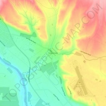
Naam: Topografische kaart Muttontown, hoogte, reliëf.
Gemiddelde hoogte: 207 m
Minimale hoogte: 137 m
Maximale hoogte: 284 m
Andere topografische kaarten
Klik op een kaart om zijn topografie, zijn hoogte en zijn reliëf te bekijken.
Clyde Dam
New Zealand > Otago > Central Otago District > Vincent Community > Clyde
Clyde Dam, Clyde, Vincent Community, Central Otago District, Otago, New Zealand
Gemiddelde hoogte: 318 m