
Topografische kaart Cripple Creek
Interactieve kaart
Klik op de kaart om de hoogte weer te geven.
Over deze kaart
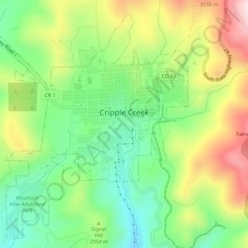
Naam: Topografische kaart Cripple Creek, hoogte, reliëf.
Gemiddelde hoogte: 2.946 m
Minimale hoogte: 2.796 m
Maximale hoogte: 3.165 m
For many years, Cripple Creek's high valley, at an elevation of 9,494 feet (2,894 m), was considered no more important than a cattle pasture. Many prospectors avoided the area after the Mount Pisgah hoax, a mini gold rush caused by salting (adding gold to worthless rock).