
Topografische kaart Monona County
Interactieve kaart
Klik op de kaart om de hoogte weer te geven.
Over deze kaart
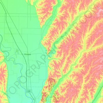
Naam: Topografische kaart Monona County, hoogte, reliëf.
Locatie: Monona County, Iowa, United States of America (41.86188 -96.35987 42.21486 -95.67046)
Gemiddelde hoogte: 359 m
Minimale hoogte: 304 m
Maximale hoogte: 460 m
Andere topografische kaarten
Klik op een kaart om zijn topografie, zijn hoogte en zijn reliëf te bekijken.
Iowa County
United States of America > Iowa
Iowa County, Iowa, United States of America
Gemiddelde hoogte: 249 m
Woodbury County
United States of America > Iowa
Woodbury County, Iowa, United States of America
Gemiddelde hoogte: 376 m
Linn County
United States of America > Iowa
Linn County, Iowa, United States of America
Gemiddelde hoogte: 261 m