
Topografische kaart East Taghkanic
Interactieve kaart
Klik op de kaart om de hoogte weer te geven.
Over deze kaart
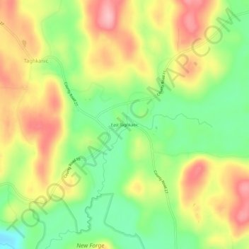
Naam: Topografische kaart East Taghkanic, hoogte, reliëf.
Gemiddelde hoogte: 200 m
Minimale hoogte: 128 m
Maximale hoogte: 275 m
Andere topografische kaarten
Klik op een kaart om zijn topografie, zijn hoogte en zijn reliëf te bekijken.
New Forge
United States > New York > Columbia County > Town of Taghkanic
New Forge, Town of Taghkanic, Columbia County, New York, 12502, United States
Gemiddelde hoogte: 193 m
West Taghkanic
United States > New York > Columbia County > Town of Taghkanic
West Taghkanic, Town of Taghkanic, Columbia County, New York, United States
Gemiddelde hoogte: 147 m