
Topografische kaart Mapusa
Klik op de kaart om de hoogte weer te geven.
Mapusa
Mapusa is located at 15°36′N 73°49′E / 15.60°N 73.82°E / 15.60; 73.82. It has an average elevation of 15 metres (49 feet).It lies on the banks of Mapusa River. Mapusa has a tropical climate with temperatures ranging from a high of 37 °C in summer with high levels of humidity to a low of 21 °C in winters.
Over deze kaart
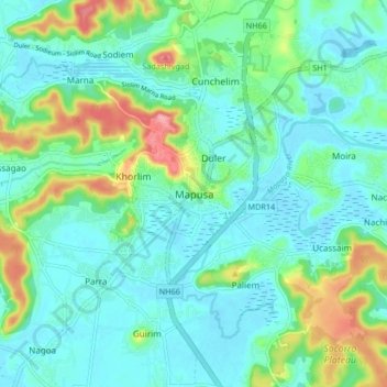
Naam: Topografische kaart Mapusa, hoogte, reliëf.
Locatie: Mapusa, Bardez, North Goa, Goa, 403507, India (15.55265 73.77197 15.63265 73.85197)
Gemiddelde hoogte: 26 m
Minimale hoogte: -3 m
Maximale hoogte: 110 m
Andere topografische kaarten
Klik op een kaart om zijn topografie, zijn hoogte en zijn reliëf te bekijken.