
Topografische kaart St. Joseph Island
Interactieve kaart
Klik op de kaart om de hoogte weer te geven.
Over deze kaart
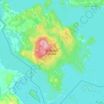
Naam: Topografische kaart St. Joseph Island, hoogte, reliëf.
Gemiddelde hoogte: 196 m
Minimale hoogte: 171 m
Maximale hoogte: 348 m
Its highest point, known colloquially and by surveyors as "the Mountain," is near the centre of the island near Carterton with an elevation of 345.6 m, which is about 169 m above Lake Huron.